Geolocate

Spinetta topographic map

Click on the map to display elevation.

About this map

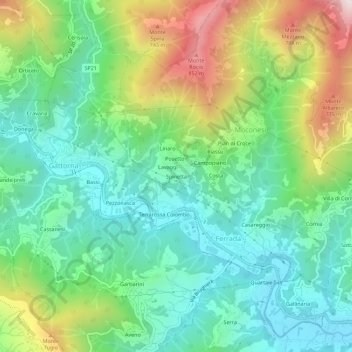
Name: Spinetta topographic map, elevation, terrain.

Location: Spinetta, Ferrada, Moconesi, Genoa, Liguria, 16047, Italy (44.40796 9.18217 44.44796 9.22217)

Average elevation: 359 m

Minimum elevation: 79 m

Maximum elevation: 959 m

Gear up for your next adventure:

🥾Lightweight Hiking Shoes - Comfortable shoes for day hikes
🧤Rechargeable Heated Gloves - Extreme warmth for Canadian winter expeditions
🦯Trekking Poles - Reduced impact on joints for steep topographic climbs
Backpacking Tent - Lightweight tent for long-distance hiking trips
👟Leg Gaiters - Keep debris, mud, and snow out of your boots

As an Amazon Associate, this site earns from qualifying purchases at no extra cost to you.