Geolocate

Butte County topographic map

Click on the map to display elevation.

About this map

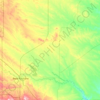
Name: Butte County topographic map, elevation, terrain.

Location: Butte County, South Dakota, United States (44.57076 -104.05776 45.21435 -102.95761)

Average elevation: 928 m

Minimum elevation: 776 m

Maximum elevation: 1,364 m

Other topographic maps

Click on a map to view its topography, its elevation and its terrain.

Spearfish

United States > South Dakota > Lawrence County > Spearfish

Average elevation: 1,291 m

Gear up for your next adventure:

🧥Thermal Layer - Insulating layer for cold outdoor conditions
🔋Lithium AA Batteries - Long-lasting power that performs in extreme cold
🔥Camping Stove - Portable stoves to cook outdoors with ease
🧴Bear Spray Holster - Quick-access carry for essential Canadian wilderness safety
🧦Outdoor Socks - Durable socks designed for hiking and outdoor sports

As an Amazon Associate, this site earns from qualifying purchases at no extra cost to you.