
Baghai topographic map
Interactive map
Click on the map to display elevation.
About this map
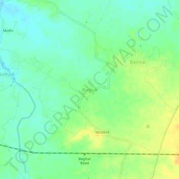
Name: Baghai topographic map, elevation, terrain.
Location: Baghai, Rampur Baghelan Tahsil, Satna, Madhya Pradesh, Inde (24.54525 81.03293 24.58525 81.07293)
Average elevation: 299 m
Minimum elevation: 288 m
Maximum elevation: 314 m
Other topographic maps
Click on a map to view its topography, its elevation and its terrain.
Jamuna
Inde > Madhya Pradesh > Rampur Baghelan Tahsil
Jamuna, Rampur Baghelan Tahsil, Satna, Madhya Pradesh, Inde
Average elevation: 315 m