Geolocate

Purmerend topographic map

Click on the map to display elevation.

About this map

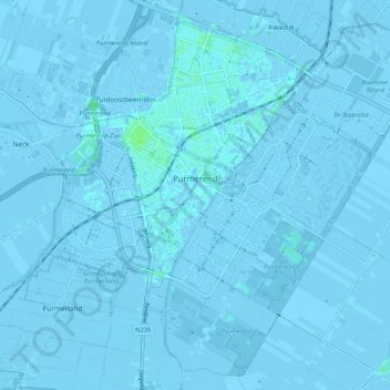
Name: Purmerend topographic map, elevation, terrain.

Location: Purmerend, North Holland, Netherlands (52.47035 4.92065 52.52911 5.02470)

Average elevation: -2 m

Minimum elevation: -6 m

Maximum elevation: 6 m

Gear up for your next adventure:

Camping Essentials - All-in-one gear for a comfortable camping trip
🥘Camping Cookware Set - Compact nesting pots and pans for trail cooking
🪑Ultralight Camping Stool - Compact seating for rest stops during long hikes
🥾Hiking Gaiters - Protect legs and shoes from mud, snow, and debris
🏃Hydration Running Vest - Carry water and maps close to your body for speed

As an Amazon Associate, this site earns from qualifying purchases at no extra cost to you.