
Thank you for supporting this site ❤️
Make a donation
Make a donation
Gear up for your next adventure:
As an Amazon Associate, this site earns from qualifying purchases at no extra cost to you.
Thadlaskein topographic map
Click on the map to display elevation.
Thank you for supporting this site ❤️
Make a donation
Make a donation
Gear up for your next adventure:
As an Amazon Associate, this site earns from qualifying purchases at no extra cost to you.
About this map
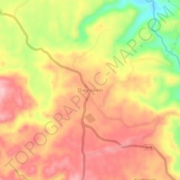
Name: Thadlaskein topographic map, elevation, terrain.
Location: Thadlaskein, West Jaintia Hills District, Meghalaya, India (25.48330 92.15310 25.52330 92.19310)
Average elevation: 1,349 m
Minimum elevation: 1,240 m
Maximum elevation: 1,414 m
Thank you for supporting this site ❤️
Make a donation
Make a donation
Gear up for your next adventure:
As an Amazon Associate, this site earns from qualifying purchases at no extra cost to you.