Geolocate

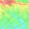
Les Rochettes topographic map

Click on the map to display elevation.

About this map

Name: Les Rochettes topographic map, elevation, terrain.

Location: Les Rochettes, Loiron, Loiron-Ruillé, Laval, Mayenne, Pays de la Loire, France métropolitaine, 53320, France (48.04062 -0.95217 48.08062 -0.91217)

Average elevation: 136 m

Minimum elevation: 99 m

Maximum elevation: 174 m

Other topographic maps

Click on a map to view its topography, its elevation and its terrain.
Gear up for your next adventure:

🕶️Polarized Sunglasses - Protect your eyes with durable polarized lenses
⛺Family Camping Tent - Spacious tent suitable for family camping trips
🧭GPS Handheld Device - Reliable GPS navigation for outdoor adventures
🦌Outdoor Trail Camera - Monitor wildlife activity near your favorite spots
🐕Hiking Dog Pack - Let your canine companion carry their own water and food

As an Amazon Associate, this site earns from qualifying purchases at no extra cost to you.