
Thank you for supporting this site ❤️
Make a donation
Make a donation
Gear up for your next adventure:
As an Amazon Associate, this site earns from qualifying purchases at no extra cost to you.
Hendou topographic map
Click on the map to display elevation.
Thank you for supporting this site ❤️
Make a donation
Make a donation
Gear up for your next adventure:
As an Amazon Associate, this site earns from qualifying purchases at no extra cost to you.
About this map
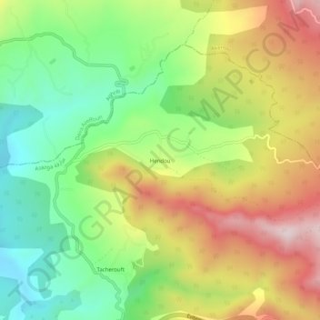
Name: Hendou topographic map, elevation, terrain.
Location: Hendou, Azazga, Daïra Azazga, Tizi Ouzou, 15300, Algérie (36.76207 4.35969 36.80207 4.39969)
Average elevation: 421 m
Minimum elevation: 190 m
Maximum elevation: 714 m
Thank you for supporting this site ❤️
Make a donation
Make a donation
Gear up for your next adventure:
As an Amazon Associate, this site earns from qualifying purchases at no extra cost to you.