Geolocate

Compin topographic map

Click on the map to display elevation.

About this map

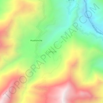
Name: Compin topographic map, elevation, terrain.

Location: Compin, Marmot, Gran Chimú, La Libertad, Perú (-7.71864 -78.64587 -7.67864 -78.60587)

Average elevation: 1,702 m

Minimum elevation: 1,045 m

Maximum elevation: 2,483 m

Gear up for your next adventure:

🛶Canoe Life Vest - Safety vest for water sports
🔭Outdoor Binoculars - Lightweight binoculars for birdwatching and hiking
🧴Outdoor Sunscreen - High SPF protection for high-altitude UV exposure
🛶Waterproof Dry Bags - Keep electronics and clothes dry during river crossings
🥾Waterproof Hiking Shoes - Durable shoes for wet and rugged trails

As an Amazon Associate, this site earns from qualifying purchases at no extra cost to you.