Geolocate

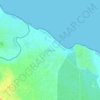
Mikocheni topographic map

Click on the map to display elevation.

About this map

Name: Mikocheni topographic map, elevation, terrain.

Location: Mikocheni, Kinondoni Municipal, Dar es Salaam, Coastal Zone, Tanzania (-6.77855 39.22624 -6.74750 39.26424)

Average elevation: 17 m

Minimum elevation: -1 m

Maximum elevation: 42 m

Other topographic maps

Click on a map to view its topography, its elevation and its terrain.

Zingiziwa

Tanzania > Dar es Salaam

Average elevation: 99 m

Kivule

Tanzania > Dar es Salaam

Average elevation: 50 m

Mbweni

Tanzania > Dar es Salaam

Average elevation: 7 m

Gear up for your next adventure:

🧢Sun Protection Cap - Breathable cap to protect from sun exposure
🥾Trekking Poles - Adjustable trekking poles to reduce knee stress and improve stability
🚲Bike Repair Kit - Essential tools for on-trail mechanical issues
🧴Insect Repellent - Protect yourself from bugs during outdoor adventures
🧼Travel Hand Sanitizer - Keep hands clean when water is scarce

As an Amazon Associate, this site earns from qualifying purchases at no extra cost to you.