Geolocate

Sipirra topographic map

Click on the map to display elevation.

About this map

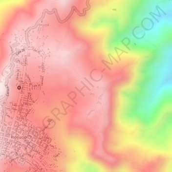
Name: Sipirra topographic map, elevation, terrain.

Location: Sipirra, Riosucio, Alto Occidente, Caldas, Colombia (5.41896 -75.70244 5.43896 -75.68244)

Average elevation: 1,670 m

Minimum elevation: 1,318 m

Maximum elevation: 1,828 m

Gear up for your next adventure:

🐕Hiking Dog Pack - Let your canine companion carry their own water and food
🔭Outdoor Binoculars - Lightweight binoculars for birdwatching and hiking
🧣Evaporative Cooling Towel - Beat the heat during intense summer climbs
💡LED Camping Lantern - Illuminate your campsite with long-lasting lanterns
🧥Packable Rain Jacket - Breathable waterproof layer for unpredictable weather

As an Amazon Associate, this site earns from qualifying purchases at no extra cost to you.