Geolocate

Grafton topographic map

Click on the map to display elevation.

About this map
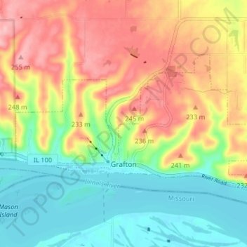
Name: Grafton topographic map, elevation, terrain.

Location: Grafton, Jersey County, Illinois, United States (38.96384 -90.45988 38.99228 -90.39490)

Average elevation: 186 m

Minimum elevation: 126 m

Maximum elevation: 260 m

Other topographic maps

Click on a map to view its topography, its elevation and its terrain.

Lockhaven

United States > Illinois > Jersey County

Average elevation: 142 m

Dow

United States > Illinois > Jersey County

Average elevation: 197 m

Gear up for your next adventure:

🎒Backpack Rain Cover - External shield to keep your entire pack dry
⛺Backpacking Tent - Lightweight tent for long-distance hiking trips
🦶Hiking Shoe Insoles - Added support for high arches and long days on feet
🚲MTB Frame Bag - Carry tools and maps directly on your bicycle frame
🧦Hiking Socks - Moisture-wicking and comfortable socks for long hikes

As an Amazon Associate, this site earns from qualifying purchases at no extra cost to you.