Geolocate

Alberobello topographic map

Click on the map to display elevation.

About this map

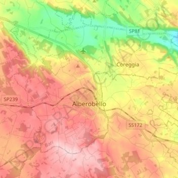
Name: Alberobello topographic map, elevation, terrain.

Location: Alberobello, Bari, Apulia, 70011, Italy (40.75738 17.18450 40.82628 17.31006)

Average elevation: 400 m

Minimum elevation: 274 m

Maximum elevation: 502 m

Other topographic maps

Click on a map to view its topography, its elevation and its terrain.

Altamura

Italy > Apulia > Bari > Altamura

Average elevation: 409 m

Polignano a Mare

Italy > Apulia > Bari

Average elevation: 42 m

Monte Belvedere

Italy > Apulia > Bari > Altamura

Average elevation: 456 m

Gear up for your next adventure:

🥾Hiking Shoes - Durable and comfortable shoes for trail hiking
Backpacking Tent - Lightweight tent for long-distance hiking trips
🧴Waterproofing Spray - Restore the DWR coating on jackets and tents
🔦LED Headlamp - Hands-free lighting for early morning starts or late finishes
🧶550 Survival Paracord - Versatile utility cord for emergency repairs and rigging

As an Amazon Associate, this site earns from qualifying purchases at no extra cost to you.