Geolocate

Tampakan topographic map

Click on the map to display elevation.

About this map

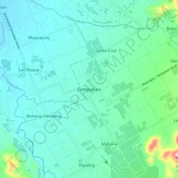
Name: Tampakan topographic map, elevation, terrain.

Location: Tampakan, South Cotabato, Soccsksargen, Philippines (6.40376 124.88691 6.48376 124.96691)

Average elevation: 142 m

Minimum elevation: 69 m

Maximum elevation: 529 m

Other topographic maps

Click on a map to view its topography, its elevation and its terrain.

Koronadal

Philippines > South Cotabato

Average elevation: 164 m

Polomolok

Philippines > South Cotabato

Average elevation: 485 m

Gear up for your next adventure:

🚲Heavy Duty Bike Lock - Secure your bike at the trailhead or during stops
🧴Sunscreen SPF - Broad-spectrum sunscreen for outdoor activities
Tent Footprint - Protect tent floor and increase durability
🧶550 Survival Paracord - Versatile utility cord for emergency repairs and rigging
💡Portable Camping Lamp - Rechargeable lamp for campsite lighting

As an Amazon Associate, this site earns from qualifying purchases at no extra cost to you.