Geolocate

Rijswijk topographic map

Click on the map to display elevation.

About this map

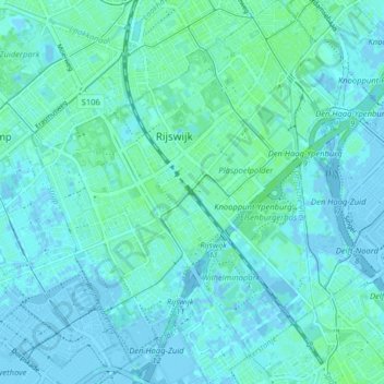
Name: Rijswijk topographic map, elevation, terrain.

Location: Rijswijk, South Holland, Netherlands (52.01278 4.29095 52.06195 4.35785)

Average elevation: 2 m

Minimum elevation: -5 m

Maximum elevation: 6 m

Gear up for your next adventure:

🥾Trail Hiking Socks - Comfortable socks to prevent blisters and fatigue
🥾Hiking Gaiters - Protect legs and shoes from mud, snow, and debris
🪑Ultralight Camping Stool - Compact seating for rest stops during long hikes
🐕Hiking Dog Pack - Let your canine companion carry their own water and food
💡Solar Camping Lamp - Eco-friendly lighting for campsites

As an Amazon Associate, this site earns from qualifying purchases at no extra cost to you.