
Kakuma topographic map
Interactive map
Click on the map to display elevation.
About this map
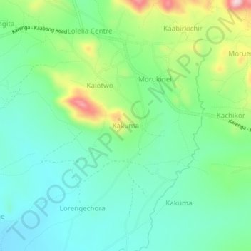
Name: Kakuma topographic map, elevation, terrain.
Location: Kakuma, Kaabong, Northern Region, Uganda (3.50100 34.02919 3.54100 34.06919)
Average elevation: 1,535 m
Minimum elevation: 1,458 m
Maximum elevation: 1,722 m
Other topographic maps
Click on a map to view its topography, its elevation and its terrain.
Mount Morungole
Mount Morungole, Kaabong, Northern Region, Uganda
Average elevation: 2,388 m
Kidepo Valley National Park
Kidepo Valley National Park, Kaabong, Northern Region, Uganda
Average elevation: 1,309 m