
Make a donation
Gear up for your next adventure:
As an Amazon Associate, this site earns from qualifying purchases at no extra cost to you.
Alfen topographic map
Click on the map to display elevation.
Make a donation
Gear up for your next adventure:
As an Amazon Associate, this site earns from qualifying purchases at no extra cost to you.
Alfen
1487 wird der Ort erstmals unter der Bezeichnung „Alffen“ in Darlehenslisten für Wilhelm III. von Berg genannt. Die Karte Topographia Ducatus Montani aus dem Jahre 1715 zeigt zwei Höfe und bezeichnet sie mit „Alf“. Die Topographische Aufnahme der Rheinlande von 1825 zeigt auf umgrenztem Hofraum fünf getrennt voneinander liegende Grundrisse und bezeichnet sie mit „Alfer“. Ab der topografischen Karte von 1894 bis 1896 wird die Ortsbezeichnung Alfen verwendet.
Make a donation
Gear up for your next adventure:
As an Amazon Associate, this site earns from qualifying purchases at no extra cost to you.
About this map
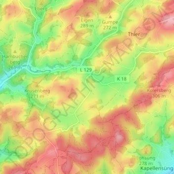
Name: Alfen topographic map, elevation, terrain.
Average elevation: 262 m
Minimum elevation: 191 m
Maximum elevation: 322 m
Make a donation
Gear up for your next adventure:
As an Amazon Associate, this site earns from qualifying purchases at no extra cost to you.