Geolocate

Pajac topographic map

Click on the map to display elevation.

About this map

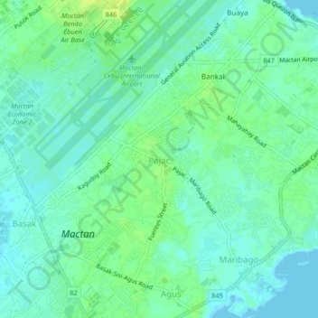
Name: Pajac topographic map, elevation, terrain.

Location: Pajac, Lapu-Lapu, Central Visayas, 6015, Philippines (10.27765 123.96279 10.31765 124.00279)

Average elevation: 6 m

Minimum elevation: -2 m

Maximum elevation: 15 m

Other topographic maps

Click on a map to view its topography, its elevation and its terrain.

Punta Engaño

Philippines > Lapu-Lapu

Average elevation: 2 m

San Vicente

Philippines > Lapu-Lapu

Average elevation: 2 m

Gear up for your next adventure:

🦶Anti-Blister Balm - Prevents friction and hotspots during long ascents
👟Sport Hiking Sandals - Breathable footwear for water crossings and camp rest
💧Hydration Pack - Hands-free hydration system for long hikes
🧥Ultralight Puffy Jacket - Maximum warmth that packs down to the size of an orange
🥾Mountain Trail Shoes - High-traction shoes for mountain trails

As an Amazon Associate, this site earns from qualifying purchases at no extra cost to you.