

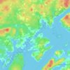
Fox Island topographic map
Click on the map to display elevation.
About this map

Name: Fox Island topographic map, elevation, terrain.
Average elevation: 41 m
Minimum elevation: -3 m
Maximum elevation: 274 m
Muncipality of Eastern Charlotte trails, hiking, mountain biking, running and outdoor activities
Other topographic maps
Click on a map to view its topography, its elevation and its terrain.
Letang
Canada > New Brunswick > Muncipality of Eastern Charlotte > Saint George Parish
Average elevation: 17 m