
Town of Darien topographic map
Interactive map
Click on the map to display elevation.
About this map
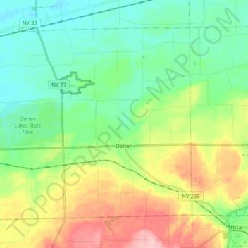
Name: Town of Darien topographic map, elevation, terrain.
Average elevation: 309 m
Minimum elevation: 255 m
Maximum elevation: 418 m
Other topographic maps
Click on a map to view its topography, its elevation and its terrain.
Darien Center
United States > New York > Genesee County > Town of Darien
Darien Center, Town of Darien, Genesee County, New York, 14040, United States
Average elevation: 307 m
Batavia
United States > New York > Genesee County > Batavia
Batavia, City of Batavia, Genesee County, New York, 14020, United States
Average elevation: 268 m
Fun Lake
United States > New York > Genesee County
Fun Lake, Genesee County, New York, United States
Average elevation: 281 m