
Pressath topographic map
Click on the map to display elevation.
About this map
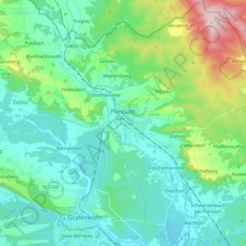
Name: Pressath topographic map, elevation, terrain.
Average elevation: 470 m
Minimum elevation: 400 m
Maximum elevation: 723 m
Other topographic maps
Click on a map to view its topography, its elevation and its terrain.
Kleinberg
Germany > Bavaria > Landkreis Neustadt an der Waldnaab > Kirchendemenreuth
Average elevation: 471 m