Geolocate

Mahalaxmi topographic map

Click on the map to display elevation.

About this map

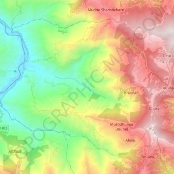
Name: Mahalaxmi topographic map, elevation, terrain.

Location: Mahalaxmi, Dhankuta, Koshi Province, Nepal (27.07779 87.24670 27.19038 87.40725)

Average elevation: 1,342 m

Minimum elevation: 238 m

Maximum elevation: 2,766 m

Gear up for your next adventure:

🦶Anti-Blister Balm - Prevents friction and hotspots during long ascents
🥾Approach Shoes - Shoes designed for climbing approaches and rugged trails
🕶️Polarized Sunglasses - Reduces glare from snow and water at high elevations
🥾Lightweight Hiking Shoes - Comfortable shoes for day hikes
🧣Evaporative Cooling Towel - Beat the heat during intense summer climbs

As an Amazon Associate, this site earns from qualifying purchases at no extra cost to you.