Geolocate

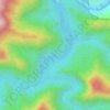
Gamis topographic map

Click on the map to display elevation.

About this map

Name: Gamis topographic map, elevation, terrain.

Location: Gamis, Quirino, Cagayan Valley, Philippines (16.48680 121.55665 16.52680 121.59665)

Average elevation: 123 m

Minimum elevation: 96 m

Maximum elevation: 178 m

Other topographic maps

Click on a map to view its topography, its elevation and its terrain.
Cagayan River

Philippines > Quirino

Average elevation: 443 m

Maddela

Philippines > Quirino

Average elevation: 446 m

Addalam River

Philippines > Quirino

Average elevation: 456 m

Saguday

Philippines > Quirino

Average elevation: 112 m

Aglipay

Philippines > Quirino

Average elevation: 185 m

Cabarroguis

Philippines > Quirino

Average elevation: 296 m

Nagtipunan

Philippines > Quirino

Average elevation: 547 m

Diffun

Philippines > Quirino

Average elevation: 252 m

Maddela

Philippines > Quirino

Average elevation: 446 m

Gear up for your next adventure:

🔥Camping Stove - Portable stoves to cook outdoors with ease
🧭GPS Handheld Device - Reliable GPS navigation for outdoor adventures
🧣Evaporative Cooling Towel - Beat the heat during intense summer climbs
🦯Trekking Poles - Reduced impact on joints for steep topographic climbs
🛶Canoe Life Vest - Safety vest for water sports

As an Amazon Associate, this site earns from qualifying purchases at no extra cost to you.