Geolocate

Misibis topographic map

Click on the map to display elevation.

About this map

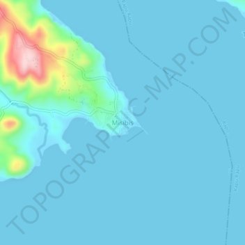
Name: Misibis topographic map, elevation, terrain.

Location: Misibis, Bacacay, Albay, Bicol Region, Philippines (13.22587 123.88606 13.26587 123.92606)

Average elevation: 29 m

Minimum elevation: -1 m

Maximum elevation: 235 m

Other topographic maps

Click on a map to view its topography, its elevation and its terrain.

Pinamuntugan Island

Philippines > Albay > Bacacay > Busdac

Average elevation: 8 m

Gear up for your next adventure:

🧥Waterproof Pants - Keep dry during rainy hiking conditions
🧰Survival Kit - Essential gear for emergencies in the wilderness
🚲Handlebar Phone Mount - View topographic-map.com live while cycling
🥾Lightweight Hiking Boots - Boots for comfort and mobility on long hikes
🩹Compact First Aid Kit - Pre-packed essentials for common trail injuries

As an Amazon Associate, this site earns from qualifying purchases at no extra cost to you.