
Thank you for supporting this site ❤️
Make a donation
Make a donation
Gear up for your next adventure:
As an Amazon Associate, this site earns from qualifying purchases at no extra cost to you.
Darchen topographic map
Click on the map to display elevation.
Thank you for supporting this site ❤️
Make a donation
Make a donation
Gear up for your next adventure:
As an Amazon Associate, this site earns from qualifying purchases at no extra cost to you.
About this map
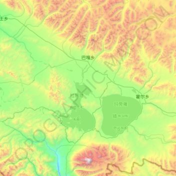
Name: Darchen topographic map, elevation, terrain.
Location: Darchen, Purang County, Ngari Prefecture, Tibet, China (30.42061 80.54186 31.21109 81.60714)
Average elevation: 5,008 m
Minimum elevation: 4,034 m
Maximum elevation: 7,625 m
Thank you for supporting this site ❤️
Make a donation
Make a donation
Gear up for your next adventure:
As an Amazon Associate, this site earns from qualifying purchases at no extra cost to you.