Geolocate

Cervás topographic map

Click on the map to display elevation.

About this map

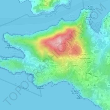
Name: Cervás topographic map, elevation, terrain.

Location: Cervás, Ares, Ferrol, A Coruña, Galicia, 15625, Spain (43.43382 -8.31656 43.45979 -8.26309)

Average elevation: 44 m

Minimum elevation: -1 m

Maximum elevation: 259 m

Gear up for your next adventure:

🧥Softshell Jacket - Windproof and breathable jacket for hiking
❄️Traction Ice Cleats - Slip-on spikes for icy trails and winter hiking
🧭GPS Handheld Device - Reliable GPS navigation for outdoor adventures
🥾Hiking Shorts - Breathable shorts suitable for summer hikes
Camping Tent - Weather-resistant tents suitable for 2 to 6 people

As an Amazon Associate, this site earns from qualifying purchases at no extra cost to you.