Geolocate

El Volcan topographic map

Click on the map to display elevation.

About this map

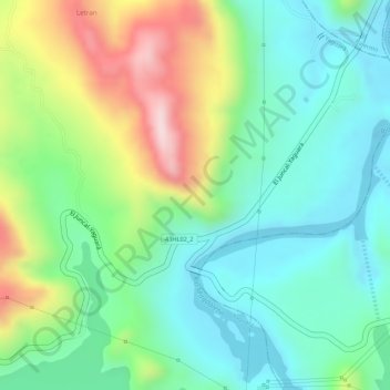
Name: El Volcan topographic map, elevation, terrain.

Location: El Volcan, Yaguará, Norte, Huila, Colombia (2.71243 -75.44705 2.73243 -75.42705)

Average elevation: 593 m

Minimum elevation: 479 m

Maximum elevation: 808 m

Other topographic maps

Click on a map to view its topography, its elevation and its terrain.

Represa de Betania

Colombia > Huila > Yaguará

Average elevation: 562 m

Gear up for your next adventure:

🧼Biodegradable Camp Soap - Environmentally friendly cleaning for gear and body
🍽️Titanium Camping Spork - Ultralight and indestructible eating utensil
🧴Sunscreen SPF - Broad-spectrum sunscreen for outdoor activities
🦟Insect Repellent - Keep mosquitoes and black flies away in wooded areas
🪑Ultralight Camping Stool - Compact seating for rest stops during long hikes

As an Amazon Associate, this site earns from qualifying purchases at no extra cost to you.