Geolocate

Andover topographic map

Click on the map to display elevation.

About this map

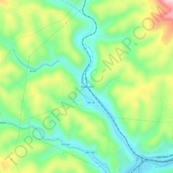
Name: Andover topographic map, elevation, terrain.

Location: Andover, Wise County, Virginia, 24215, United States (36.90371 -82.81655 36.94371 -82.77655)

Average elevation: 616 m

Minimum elevation: 496 m

Maximum elevation: 827 m

Gear up for your next adventure:

🪑Insulated Seat Pad - Protect your seat from cold rocks and wet logs
🧢Hiking Hat - Sun-protective and breathable hats for long treks
💧Reusable Water Bottle - Durable water bottles for hydration on trails
🧴Outdoor Sunscreen - High SPF protection for high-altitude UV exposure
🏃Hydration Running Vest - Carry water and maps close to your body for speed

As an Amazon Associate, this site earns from qualifying purchases at no extra cost to you.