Geolocate

La Monnerie topographic map

Click on the map to display elevation.

About this map
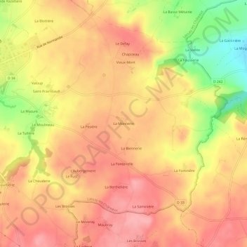
Name: La Monnerie topographic map, elevation, terrain.

Location: La Monnerie, Lassay-les-Châteaux, Mayenne, Pays de la Loire, France métropolitaine, 53110, France (48.41185 -0.47727 48.45185 -0.43727)

Average elevation: 228 m

Minimum elevation: 158 m

Maximum elevation: 264 m

Other topographic maps

Click on a map to view its topography, its elevation and its terrain.

Gear up for your next adventure:

🥾Trail Running Boots - Durable shoes designed for trail running
🥾Trekking Boots - Durable boots for long-distance trekking
💡Solar Camping Lamp - Eco-friendly lighting for campsites
🧭GPS Handheld Device - Reliable GPS navigation for outdoor adventures
🥾All-Terrain Hiking Boots - Versatile boots for varied hiking conditions

As an Amazon Associate, this site earns from qualifying purchases at no extra cost to you.