
Darien topographic map
Click on the map to display elevation.
About this map
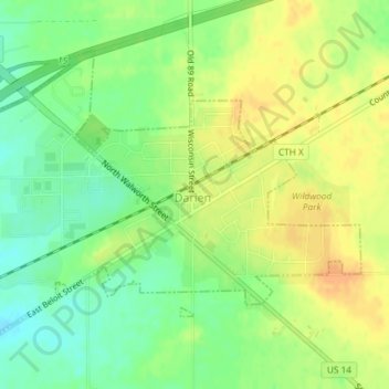
Name: Darien topographic map, elevation, terrain.
Location: Darien, Walworth County, Wisconsin, 53114, United States (42.59145 -88.72753 42.61157 -88.69182)
Average elevation: 287 m
Minimum elevation: 270 m
Maximum elevation: 302 m
Other topographic maps
Click on a map to view its topography, its elevation and its terrain.
Pell Lake
United States > Wisconsin > Walworth County > Village of Bloomfield
Average elevation: 263 m