
Thank you for supporting this site ❤️
Make a donation
Make a donation
Gear up for your next adventure:
As an Amazon Associate, this site earns from qualifying purchases at no extra cost to you.
Pasel topographic map
Click on the map to display elevation.
Thank you for supporting this site ❤️
Make a donation
Make a donation
Gear up for your next adventure:
As an Amazon Associate, this site earns from qualifying purchases at no extra cost to you.
About this map
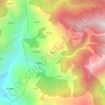
Name: Pasel topographic map, elevation, terrain.
Location: Pasel, Doda, Doda District, Jammu und Kaschmir, 182145, Indien (33.19134 75.36508 33.23134 75.40508)
Average elevation: 2,250 m
Minimum elevation: 1,407 m
Maximum elevation: 3,090 m
Thank you for supporting this site ❤️
Make a donation
Make a donation
Gear up for your next adventure:
As an Amazon Associate, this site earns from qualifying purchases at no extra cost to you.