
Al Hayit topographic map
Interactive map
Click on the map to display elevation.
About this map
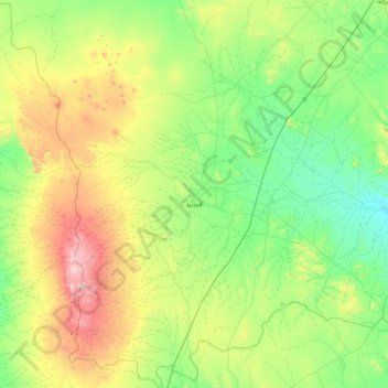
Name: Al Hayit topographic map, elevation, terrain.
Location: Al Hayit, Haïl, 57353, Arabie saoudite (25.25439 39.90627 26.79025 41.22527)
Average elevation: 1,135 m
Minimum elevation: 888 m
Maximum elevation: 1,995 m
Other topographic maps
Click on a map to view its topography, its elevation and its terrain.