
Make a donation
Gear up for your next adventure:
As an Amazon Associate, this site earns from qualifying purchases at no extra cost to you.
Loma Linda topographic map
Click on the map to display elevation.
Make a donation
Gear up for your next adventure:
As an Amazon Associate, this site earns from qualifying purchases at no extra cost to you.
About this map
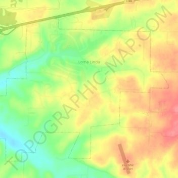
Name: Loma Linda topographic map, elevation, terrain.
Location: Loma Linda, Newton County, Missouri, United States (36.96877 -94.61489 37.00129 -94.56473)
Average elevation: 319 m
Minimum elevation: 278 m
Maximum elevation: 353 m
Make a donation
Gear up for your next adventure:
As an Amazon Associate, this site earns from qualifying purchases at no extra cost to you.
Other topographic maps
Click on a map to view its topography, its elevation and its terrain.
Shoal Creek
United States > Missouri > Newton County > Joplin > Cliff Village
Average elevation: 295 m
Make a donation
Gear up for your next adventure:
As an Amazon Associate, this site earns from qualifying purchases at no extra cost to you.