Geolocate

Lago Calima topographic map

Click on the map to display elevation.

About this map

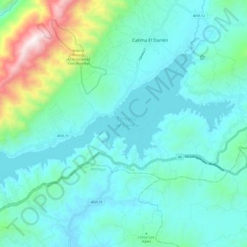
Name: Lago Calima topographic map, elevation, terrain.

Location: Lago Calima, 40VL11, Calima, Valle del Cauca, Colombia (3.85864 -76.56099 3.92510 -76.44267)

Average elevation: 1,640 m

Minimum elevation: 1,402 m

Maximum elevation: 2,739 m

Gear up for your next adventure:

🧢Outdoor Visor - Breathable visor for sunny hikes
🥾Mountain Hiking Boots - High-traction boots for rocky terrain
🦌Outdoor Trail Camera - Monitor wildlife activity near your favorite spots
🧊Portable Cooler - Keep food and drinks cold during outdoor adventures
🧢Hiking Hat - Sun-protective and breathable hats for long treks

As an Amazon Associate, this site earns from qualifying purchases at no extra cost to you.