Geolocate

Cerbaia topographic map

Click on the map to display elevation.

About this map

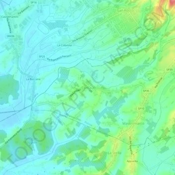
Name: Cerbaia topographic map, elevation, terrain.

Location: Cerbaia, Lamporecchio, Pistoia, Tuscany, 51036, Italy (43.78689 10.84511 43.82689 10.88511)

Average elevation: 34 m

Minimum elevation: 15 m

Maximum elevation: 96 m

Other topographic maps

Click on a map to view its topography, its elevation and its terrain.

Montale

Italy > Tuscany > Pistoia

Average elevation: 318 m

Gear up for your next adventure:

🧼Travel Hand Sanitizer - Keep hands clean when water is scarce
💧Reusable Water Bottle - Durable water bottles for hydration on trails
🧼Biodegradable Camp Soap - Environmentally friendly cleaning for gear and body
Lightweight Backpacking Tent - Compact tent for efficient hiking trips
🧤Rechargeable Heated Gloves - Extreme warmth for Canadian winter expeditions

As an Amazon Associate, this site earns from qualifying purchases at no extra cost to you.