
Make a donation
Gear up for your next adventure:
As an Amazon Associate, this site earns from qualifying purchases at no extra cost to you.
Hartline topographic map
Click on the map to display elevation.
Make a donation
Gear up for your next adventure:
As an Amazon Associate, this site earns from qualifying purchases at no extra cost to you.
About this map
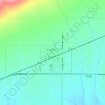
Name: Hartline topographic map, elevation, terrain.
Location: Hartline, Grant County, Washington, United States (47.68492 -119.11392 47.69561 -119.10208)
Average elevation: 586 m
Minimum elevation: 561 m
Maximum elevation: 661 m
Make a donation
Gear up for your next adventure:
As an Amazon Associate, this site earns from qualifying purchases at no extra cost to you.
Other topographic maps
Click on a map to view its topography, its elevation and its terrain.
Make a donation
Gear up for your next adventure:
As an Amazon Associate, this site earns from qualifying purchases at no extra cost to you.
Moses Lake
United States > Washington > Grant County > Moses Lake > Moses Lake
Average elevation: 342 m