
Tura topographic map
Click on the map to display elevation.
Tura
Tura is located at 25°31′N 90°13′E / 25.52°N 90.22°E / 25.52; 90.22. It has an average elevation of 349 metres (1145 feet). Its climate is a Humid Subtropical climate (Köppen climate classification: Cwa).
About this map
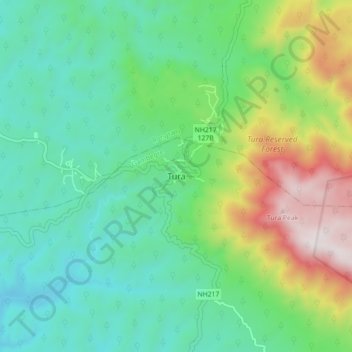
Name: Tura topographic map, elevation, terrain.
Location: Tura, Gambegre, West Garo Hills, Meghalaya, 794001, India (25.47256 90.17715 25.55256 90.25715)
Average elevation: 408 m
Minimum elevation: 73 m
Maximum elevation: 1,236 m