
Ovacık Mahallesi topographic map
Interactive map
Click on the map to display elevation.
About this map
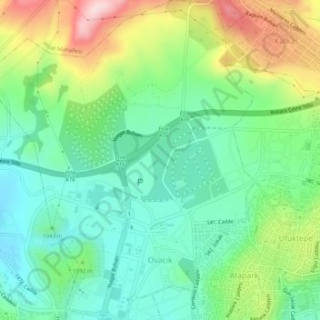
Name: Ovacık Mahallesi topographic map, elevation, terrain.
Location: Ovacık Mahallesi, Keçiören, Ankara, Zentralanatolien, Türkei (40.00267 32.80474 40.04016 32.84672)
Average elevation: 1,074 m
Minimum elevation: 969 m
Maximum elevation: 1,285 m