
Thank you for supporting this site ❤️
Make a donation
Make a donation
Gear up for your next adventure:
As an Amazon Associate, this site earns from qualifying purchases at no extra cost to you.
Capolegrotti topographic map
Click on the map to display elevation.
Thank you for supporting this site ❤️
Make a donation
Make a donation
Gear up for your next adventure:
As an Amazon Associate, this site earns from qualifying purchases at no extra cost to you.
About this map
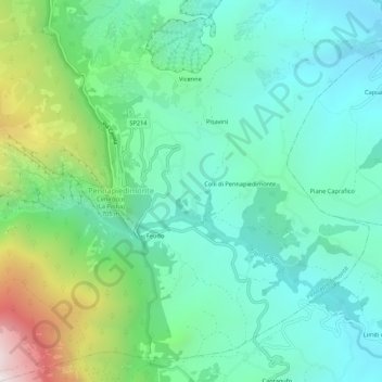
Name: Capolegrotti topographic map, elevation, terrain.
Location: Capolegrotti, Pennapiedimonte, Chieti, Abruzzo, 66016, Italia (42.13196 14.18473 42.17196 14.22473)
Average elevation: 601 m
Minimum elevation: 252 m
Maximum elevation: 1,626 m
Thank you for supporting this site ❤️
Make a donation
Make a donation
Gear up for your next adventure:
As an Amazon Associate, this site earns from qualifying purchases at no extra cost to you.