Geolocate

Bogonos topographic map

Click on the map to display elevation.

About this map

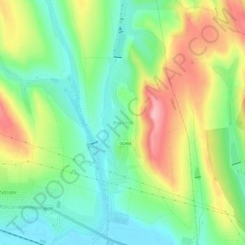
Name: Bogonos topographic map, elevation, terrain.

Location: Bogonos, Iași Metropolitan Area, Iași, 707281, Romania (47.18924 27.41351 47.22924 27.45351)

Average elevation: 100 m

Minimum elevation: 45 m

Maximum elevation: 185 m

Gear up for your next adventure:

🧢Sun Protection Cap - Breathable cap to protect from sun exposure
🔋Emergency Crank Radio - Weather alerts and power without needing batteries
🧴Sunscreen SPF - Broad-spectrum sunscreen for outdoor activities
🧭GPS Handheld Device - Reliable GPS navigation for outdoor adventures
🥾Trail Hiking Socks - Comfortable socks to prevent blisters and fatigue

As an Amazon Associate, this site earns from qualifying purchases at no extra cost to you.