Geolocate

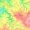
Köttern topographic map

Click on the map to display elevation.

Köttern

Köttern liegt im Norden der Großgemeinde Seelitz auf einer Höhe zwischen den Tälern des Leitebachs im Norden und des der Aubachs im Süden, welche beide in die Zwickauer Mulde münden. Südöstlich des Orts befindet sich der Kötterner Porschel, der nach dem Ort benannt ist. An Köttern führt südlich die Bundesstraße 175 vorbei.

Wikipedia (CC-BY-SA 3.0)

About this map

Name: Köttern topographic map, elevation, terrain.

Location: Köttern, Seelitz, Verwaltungsgemeinschaft Rochlitz, Mittelsachsen, Sachsen, Deutschland (51.05082 12.81388 51.06637 12.83042)

Average elevation: 213 m

Minimum elevation: 152 m

Maximum elevation: 271 m

Other topographic maps

Click on a map to view its topography, its elevation and its terrain.
Städten

Deutschland > Sachsen > Mittelsachsen > Seelitz

Average elevation: 248 m

Gear up for your next adventure:

🧦Crew Hiking Socks - Comfortable socks for long-distance hikes
🛌Insulated Sleeping Pad - Critical thermal barrier between you and the cold ground
🔪Outdoor Multitool - Versatile tool for repairs and food prep in the wild
💡Solar Camping Lamp - Eco-friendly lighting for campsites
🪜Heavy Duty Carabiners - Multi-use clips for securing gear to your backpack

As an Amazon Associate, this site earns from qualifying purchases at no extra cost to you.