
Cushman topographic map
Click on the map to display elevation.
About this map
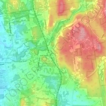
Name: Cushman topographic map, elevation, terrain.
Average elevation: 100 m
Minimum elevation: 44 m
Maximum elevation: 175 m
Other topographic maps
Click on a map to view its topography, its elevation and its terrain.
Mill River Recreation Area
United States > Massachusetts > Hampshire County > Amherst > North Amherst
Average elevation: 66 m
Wildwood Conservation Area
United States > Massachusetts > Hampshire County > Amherst
Average elevation: 89 m