Geolocate

Alcanar topographic map

Click on the map to display elevation.

About this map

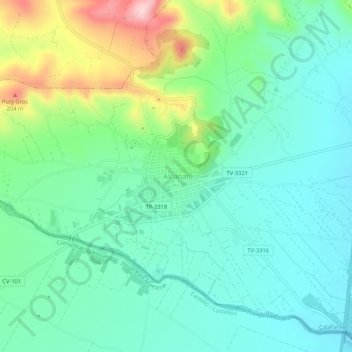
Name: Alcanar topographic map, elevation, terrain.

Location: Alcanar, Montsiá, Tarragona, Cataluña, 43530, España (40.52386 0.46084 40.56386 0.50084)

Average elevation: 73 m

Minimum elevation: 7 m

Maximum elevation: 249 m

Gear up for your next adventure:

🥾Approach Boots - Comfortable boots for hiking and climbing approaches
🧥Thermal Layer - Insulating layer for cold outdoor conditions
💧Hydration Pack - Hands-free hydration system for long hikes
👖Convertible Hiking Pants - Zip-off legs to adapt to changing weather conditions
Lightweight Camping Tent - Portable shelter optimized for Canadian backcountry camping

As an Amazon Associate, this site earns from qualifying purchases at no extra cost to you.