Geolocate

Boja topographic map

Click on the map to display elevation.

About this map

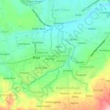
Name: Boja topographic map, elevation, terrain.

Location: Boja, Kendal, Central Java, Indonesia (-7.12366 110.25356 -7.08366 110.29356)

Average elevation: 296 m

Minimum elevation: 239 m

Maximum elevation: 406 m

Gear up for your next adventure:

🥾Approach Shoes - Shoes designed for climbing approaches and rugged trails
🔋Solar Power Bank - Keep your GPS and devices charged during long outdoor trips
🥾Mountain Trail Shoes - High-traction shoes for mountain trails
💧Filtered Water Bottle - Safe drinking water on the go
🧊Insulated Water Bottle - Keeps drinks cold in summer and prevents freezing in winter

As an Amazon Associate, this site earns from qualifying purchases at no extra cost to you.