
Thank you for supporting this site ❤️
Make a donation
Make a donation
Gear up for your next adventure:
As an Amazon Associate, this site earns from qualifying purchases at no extra cost to you.
Lazine topographic map
Click on the map to display elevation.
Thank you for supporting this site ❤️
Make a donation
Make a donation
Gear up for your next adventure:
As an Amazon Associate, this site earns from qualifying purchases at no extra cost to you.
About this map
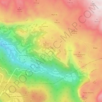
Name: Lazine topographic map, elevation, terrain.
Location: Lazine, Krnja Jela, Šavnik Municipality, Montenegro (42.90284 19.27882 42.94284 19.31882)
Average elevation: 1,550 m
Minimum elevation: 1,147 m
Maximum elevation: 1,898 m
Thank you for supporting this site ❤️
Make a donation
Make a donation
Gear up for your next adventure:
As an Amazon Associate, this site earns from qualifying purchases at no extra cost to you.