Geolocate

Sora topographic map

Click on the map to display elevation.

About this map

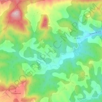
Name: Sora topographic map, elevation, terrain.

Location: Sora, Osona, Barcelona, Cataluña, 08588, España (42.09194 2.14105 42.13194 2.18105)

Average elevation: 750 m

Minimum elevation: 597 m

Maximum elevation: 997 m

Gear up for your next adventure:

🧥Softshell Hiking Jacket - The perfect balance of wind protection and breathability
🛶Kayak Dry Bag - Waterproof storage for kayaking adventures
🔦LED Flashlight - Powerful and long-lasting flashlight for camping and emergencies
💡Compact LED Flashlight - Powerful and portable flashlight for outdoor use
🥾Trail Running Shoes - Lightweight and durable shoes for trail running

As an Amazon Associate, this site earns from qualifying purchases at no extra cost to you.