
Thank you for supporting this site ❤️
Make a donation
Make a donation
Gear up for your next adventure:
As an Amazon Associate, this site earns from qualifying purchases at no extra cost to you.
Tabuadela topographic map
Click on the map to display elevation.
Thank you for supporting this site ❤️
Make a donation
Make a donation
Gear up for your next adventure:
As an Amazon Associate, this site earns from qualifying purchases at no extra cost to you.
About this map
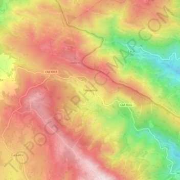
Name: Tabuadela topographic map, elevation, terrain.
Location: Tabuadela, Salto, Montalegre, Vila Real, 5470-430, Portugal (41.60593 -7.92140 41.64593 -7.88140)
Average elevation: 946 m
Minimum elevation: 639 m
Maximum elevation: 1,157 m
Thank you for supporting this site ❤️
Make a donation
Make a donation
Gear up for your next adventure:
As an Amazon Associate, this site earns from qualifying purchases at no extra cost to you.