
Thank you for supporting this site ❤️
Make a donation
Make a donation
Gear up for your next adventure:
As an Amazon Associate, this site earns from qualifying purchases at no extra cost to you.
Galicia topographic map
Click on the map to display elevation.
Thank you for supporting this site ❤️
Make a donation
Make a donation
Gear up for your next adventure:
As an Amazon Associate, this site earns from qualifying purchases at no extra cost to you.
About this map
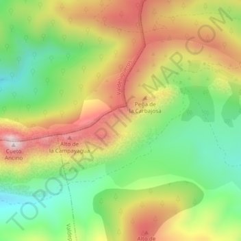
Name: Galicia topographic map, elevation, terrain.
Location: Galicia, Boñar, León, Castilla y León, 24845, España (42.90770 -5.38332 42.92770 -5.36332)
Average elevation: 1,405 m
Minimum elevation: 1,144 m
Maximum elevation: 1,710 m
Thank you for supporting this site ❤️
Make a donation
Make a donation
Gear up for your next adventure:
As an Amazon Associate, this site earns from qualifying purchases at no extra cost to you.