Geolocate

Carriu topographic map

Click on the map to display elevation.

About this map

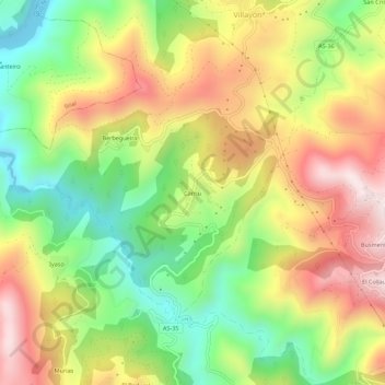
Name: Carriu topographic map, elevation, terrain.

Location: Carriu, Villayón, Asturias, 33798, Spain (43.40912 -6.73248 43.44912 -6.69248)

Average elevation: 308 m

Minimum elevation: 32 m

Maximum elevation: 614 m

Gear up for your next adventure:

🥾Trail Hiking Socks - Comfortable socks to prevent blisters and fatigue
🥾Mountain Trail Shoes - High-traction shoes for mountain trails
🗺️Topographic Maps - Detailed maps to explore trails, mountains, and wilderness areas
🍽️Titanium Camping Spork - Ultralight and indestructible eating utensil
🦌Outdoor Trail Camera - Monitor wildlife activity near your favorite spots

As an Amazon Associate, this site earns from qualifying purchases at no extra cost to you.