
Thank you for supporting this site ❤️
Make a donation
Make a donation
Gear up for your next adventure:
As an Amazon Associate, this site earns from qualifying purchases at no extra cost to you.
Spreenhagen topographic map
Click on the map to display elevation.
Thank you for supporting this site ❤️
Make a donation
Make a donation
Gear up for your next adventure:
As an Amazon Associate, this site earns from qualifying purchases at no extra cost to you.
About this map
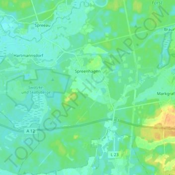
Name: Spreenhagen topographic map, elevation, terrain.
Location: Spreenhagen, Oder-Spree, Brandenburg, 15528, Germany (52.28791 13.82152 52.37754 13.91650)
Average elevation: 40 m
Minimum elevation: 33 m
Maximum elevation: 60 m
Thank you for supporting this site ❤️
Make a donation
Make a donation
Gear up for your next adventure:
As an Amazon Associate, this site earns from qualifying purchases at no extra cost to you.