Geolocate

Bethioua topographic map

Click on the map to display elevation.

About this map
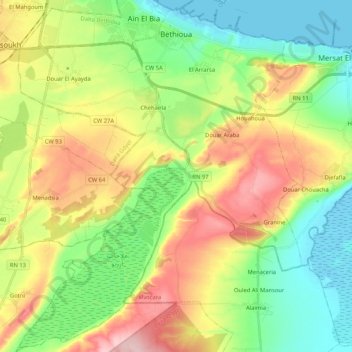
Name: Bethioua topographic map, elevation, terrain.

Location: Bethioua, Bethioua District, Oran, Algeria (35.65256 -0.36318 35.82204 -0.19304)

Average elevation: 83 m

Minimum elevation: -3 m

Maximum elevation: 214 m

Other topographic maps

Click on a map to view its topography, its elevation and its terrain.

Leɛrarsa

Algeria > Oran > Bethioua District > Bethioua

Average elevation: 57 m

Gear up for your next adventure:

🧭GPS Outdoor Watch - Smart watch for navigation and fitness tracking in nature
🥾Waterproof Hiking Shoes - Durable shoes for wet and rugged trails
🛰️Satellite Messenger - Emergency communication for areas with no cell service
☕Camping Coffee Maker - Brew fresh coffee anywhere on the topographic map
🥾Trail Hiking Socks - Comfortable socks to prevent blisters and fatigue

As an Amazon Associate, this site earns from qualifying purchases at no extra cost to you.